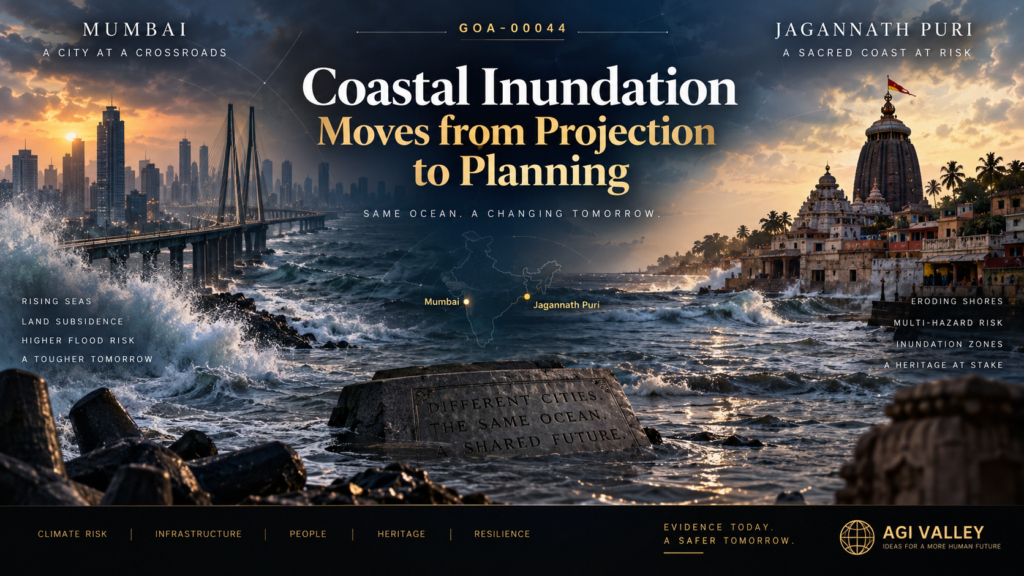
Global Observation Archive — GOA-00044
Coastal Inundation Moves from Projection to Planning
Permanent inundation is being treated as a measurable urban-planning variable rather than a distant theoretical risk.
Observation
Sea-level rise is beginning to move from a distant climate projection into a practical urban-planning variable.
On 7 September 2026, the Brihanmumbai Municipal Corporation initiated a fresh climate-risk assessment covering Mumbai’s 149-km coastline. The exercise is intended to identify vulnerable coastal stretches, inhabited areas at risk, and the changing threat of permanent inundation arising from sea-level rise, land-use change and coastal development.
This institutional shift is important.
The question is no longer only:
How much will the sea rise?
It is increasingly becoming:
Which inhabited areas may eventually become difficult to protect, occupy or retain?
Independent scientific evidence supports the direction of concern. A 2026 study in Geophysical Research Letters found that most measured land subsidence in Mumbai is approximately 2–4 mm per year, with localised hotspots reaching about 7 mm per year. Subsidence can amplify relative sea-level risk where land is already low-lying.
On 3 September 2026, the United Nations in India also specifically identified Mumbai among South Asian coastal cities where sea-level rise combined with land subsidence is increasing flooding and displacement risk.
A parallel planning signal already exists on India’s eastern coast.
CSTEP has produced sea-level-rise-induced inundation maps for Puri, Odisha, including scenarios for 2040, 2060, 2080 and 2100. The maps identify possible localised inundation within Puri municipality under different sea-level-rise pathways. This is pre-existing evidence published on 31 July 2024 — it is not a September 2026 development, and is cited here only as an independent planning precedent.
Two additional 2026 signals strengthen the Puri-side risk picture without establishing submergence. On 7 August 2026, reporting on information provided by the Union Ministry of Earth Sciences stated that approximately 81.91% of Puri district had been identified as multi-hazard-vulnerable. The underlying INCOIS mapping integrates coastal-hazard parameters including sea-level change, shoreline-change rate, elevation and extreme water levels to derive a composite hazard line for potential coastal inundation.
On 12 August 2026, reporting on a National Centre for Coastal Research shoreline assessment covering 1990–2022 stated that 10.2% of the analysed Puri district coastline was eroding. These are district-level coastal-risk indicators; they do not establish inundation of Puri city or Shree Jagannath Temple.
The important observation is therefore not that Mumbai or Puri are already being submerged.
It is that permanent inundation, exposure and adaptation are increasingly being treated as measurable planning variables rather than distant theoretical risks.
Validation Signal
Five independent layers now converge:
- Institutional planning: Mumbai is actively reassessing its entire coastline for future vulnerability and permanent-inundation exposure.
- Measured physical change: satellite-based research confirms land subsidence in parts of Mumbai.
- Forward spatial mapping: Puri already has city-specific sea-level-rise inundation scenarios extending through the century.
- Composite coastal-hazard mapping: INCOIS-linked multi-hazard mapping identifies a large share of Puri district as vulnerable when sea-level change, shoreline change, elevation and extreme water levels are considered together.
- Observed shoreline change: an NCCR assessment identifies erosion along 10.2% of the analysed Puri district coastline.
Together, these do not prove that large coastal cities or religious centres will inevitably be submerged.
They do show a movement from:
The next stage, if the trajectory continues, would be:
That final transition has not yet been established.
BNN Planetary Lens
यह खंड मेरी व्यक्तिगत मान्यता है — स्थापित विज्ञान नहीं। यह ऊपर दिए गए साक्ष्य का हिस्सा नहीं है और इस observation की validation इस पर निर्भर नहीं करती।
वर्तमान (2026) गोचर में इन तीनों बाहरी ग्रहों की राशियाँ — निरयण / लाहिड़ी अयनांश के अनुसार — मेरी ज्योतिषीय व्याख्या में जल, भूमि और मानव-निर्मित संरचनाओं पर बढ़ते दबाव का एक प्रतीकात्मक संयोजन बनाती हैं:
नेपच्यून (मीन राशि — जल तत्व)
मीन गहरे समुद्र, व्यापक जल और सीमा-विहीन विस्तार का प्रतीक है। नेपच्यून को भी ज्योतिषीय परंपरा में महासागर और विलयन से जोड़ा जाता है। मेरी व्याख्या में यह गोचर बढ़ते जल, पिघलते हिम और समुद्र के विस्तार की थीम का प्रतीकात्मक संकेत बनता है; इसे ग्लेशियर पिघलने या समुद्र-स्तर वृद्धि का वैज्ञानिक कारण नहीं माना गया है।
यूरेनस (वृषभ राशि — पृथ्वी तत्व)
वृषभ ज़मीन, स्थिरता, भौतिक आधार और सीमाओं का प्रतिनिधित्व करता है। मेरी ज्योतिषीय व्याख्या में वृषभ में यूरेनस स्थिर भू-सीमाओं, तटीय भूमि और स्थापित ढाँचों में अचानक परिवर्तन या अस्थिरता का प्रतीक है; यह टेक्टोनिक प्लेट्स के कमज़ोर होने या वास्तविक भू-धंसाव का वैज्ञानिक कारण होने का दावा नहीं है।
प्लूटो (मकर राशि — पृथ्वी तत्व)
मकर राशि संरचना, संस्थागत व्यवस्था और बड़े मानव-निर्मित ढाँचों का प्रतीक मानी जाती है। मेरी व्याख्या में मकर में प्लूटो पुराने शहरी और संस्थागत ढाँचों के गहरे रूपांतरण या विघटन की थीम को दर्शाता है — विशेषकर उन शहरों में जहाँ मानव-निर्मित विस्तार प्रकृति की सीमाओं से टकराता है।
सीधा लॉजिक
इसे मैं प्रतीकात्मक रूप से इस तरह पढ़ता हूँ: एक तरफ़ जल का विस्तार और सीमाओं का घुलना; दूसरी तरफ़ स्थिर भूमि तथा मानव-निर्मित संरचनाओं पर परिवर्तन का दबाव। वैज्ञानिक evidence ऊपर अलग दर्ज है; यह BNN lens केवल उसी वास्तविक risk pattern पर मेरी व्यक्तिगत ज्योतिषीय interpretation है।
आज वही किनारे निगलने लगे हैं उसी शहर को
मंदिर मस्जिद नहीं देखती कुदरत की ये कयामत
इंसान ने ही तो कुदरत को दी है तबाही की ये दावत
AGI Valley Convergence Note
A dated 4 September 2026 AGI Valley manuscript draft contains a fictional 2041 coastal sequence in which:
- recurring disasters and coastal surges intensify,
- the map of the world’s coastlines begins changing,
- some cities attempt to hold back the sea while others retreat,
- old Indian coastal pilgrimage locations are affected,
- water reaches temple steps,
- an older map shows the shoreline roughly 200 metres away,
- coastal-relocation projections increase,
- an evacuation takes place,
- a residential colony is shown surrounded by water,
- and the sequence ends with the sea continuing to advance.
The final manuscript deliberately does not name Mumbai or Jagannath Puri in this passage.
Mumbai and Jagannath Puri are the author-intended real-world referents, not explicit named predictions in the published prose.
Therefore, current evidence should be classified as real-world directional convergence, not fulfillment of the fictional end-state.
Evidence Boundary
This observation does not establish that:
- Mumbai will certainly become submerged,
- Puri city will certainly become submerged,
- Shree Jagannath Temple will be inundated,
- present vulnerability maps are deterministic forecasts,
- or current scientific evidence validates the final 2041 fictional outcome.
The evidence currently establishes risk direction, measured contributing processes, mapped inundation scenarios and institutional preparation.
That distinction must remain intact.
What Would Strengthen the Observation
Future evidence would materially strengthen GOA-00044 if it shows:
- official permanent-inundation zones being designated,
- mandatory retreat or relocation programmes,
- coastal land becoming officially unsuitable for permanent habitation,
- repeated tidal or sea-level flooding making neighbourhoods effectively uninhabitable,
- formal abandonment or relocation of coastal infrastructure,
- or direct documented sea-level exposure affecting major heritage or pilgrimage sites in Puri.
Until then, the end-state remains open.
Forecast & Review Protocol
- Interim Review — 31 December 2027: outcome of the BMC coastline climate-risk assessment; whether vulnerable stretches and inhabited at-risk areas are publicly identified.
- Final Review — 31 December 2030: whether any Indian coastal authority has moved from mapped exposure to binding restriction, designated inundation zones, or relocation policy.
- Review outcomes are recorded in three forms only: Strengthened / Unchanged / Weakened. A null or negative outcome will be recorded in the same form as a positive one.
- No post-publication editing. Any future validation is appended as a separate dated block; the original text above is never altered.
Important Note
This is a documented observation, not a prediction of submergence and not a scientific forecast. It records what institutions and researchers are currently measuring, mapping and planning for — and where that direction may lead if it continues. The BNN Planetary Lens above is a personal interpretive layer and carries no evidentiary weight in this record.
References
- The Indian Express — reporting on BMC’s newly commissioned climate-risk assessment of Mumbai’s 149-km coastline, 7 September 2026.
- United Nations in India — Mumbai identified among South Asian coastal cities facing combined sea-level-rise and land-subsidence risk, 3 September 2026.
- Geophysical Research Letters (2026) — satellite-based study of vertical land motion: most measured Mumbai subsidence 2–4 mm/year, with localised hotspots up to approximately 7 mm/year.
- Center for Study of Science, Technology and Policy (CSTEP) — sea-level-rise-induced inundation mapping for Puri, Odisha; scenarios for 2040, 2060, 2080 and 2100; published 31 July 2024.
- The New Indian Express — Union-government/INCOIS-linked multi-hazard mapping: approximately 81.91% of Puri district identified as multi-hazard-vulnerable, 7 August 2026.
- The New Indian Express — reporting on NCCR shoreline assessment: 10.2% of analysed Puri district coastline classified as eroding, 12 August 2026.
- AGI Valley manuscript draft, dated 4 September 2026 — author’s private archival record (fictional 2041 coastal sequence).
Global Observation Archive · Cosmic AI Labs · Bhrigu AI Astro
Observation ID: GOA-00044 | Review Status: SIGNIFICANT SIGNAL / OPEN OBSERVE • VALIDATE • DOCUMENT